We Take Our Clients to New Heights
Towill performs more than 100 aerial photogrammetric mapping projects each year, ranging from large-scale (1:200 or 1:500) mapping used for engineering design projects to small-scale mapping (1:2,500 or 1:10,000) for planning, facilities management, and environmental restoration projects. High-quality aerial photography is the foundation for most photogrammetric maps, which produce the orthophotos and base maps used in many GIS applications. At altitudes from 500 feet to 30,000 feet, we can create maps to scale using natural-color, black-and-white, and color-infrared photography precisely georeferenced with GPS and inertial measurement technologies. Based on Towill’s years of experience delivering large-scale and small-scale maps, we have developed feature compilation (data digitizing) techniques that consistently meet or exceed all requirements for detail and accuracy. Over the last 20 years, Towill has used softcopy photogrammetry workstations to extract planimetric and topographic data from aerial imagery.
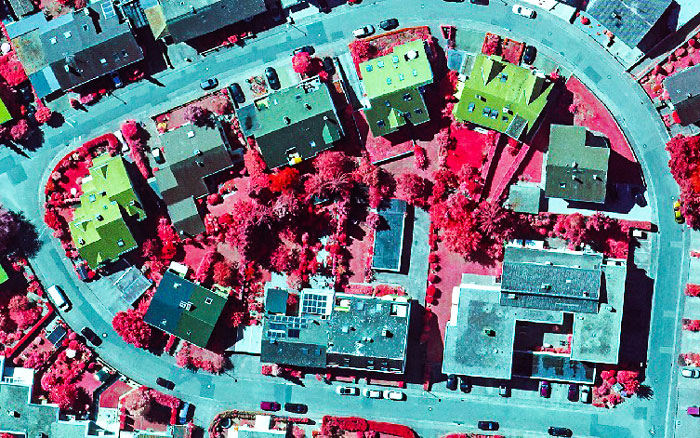
Towill has recently upgraded our airborne remote sensing systems to include the Phase One iXU-RS1000 four band (RGB-IR) camera. The iXU-RS1000 camera system is comprised of two 100 megapixel cameras where one camera is sensitive to visible light (RGB) and the second camera is sensitive to near infra-red (IR) wavelengths supplying the fourth band for RBG-IR imagery. Four band imagery is commonly used for environmental, forestry, and agricultural studies where the health and vitality of vegetation is assessed by the characteristics of its infra-red reflectance.
Towill’s professional photogrammetrists deliver high-quality topographic and planimetric mapping data woven from multiple airborne cameras and sensors, such as LiDAR (Light Detection and Ranging). Our new Phase One camera system can be co-mounted with our Optech M-300 LiDAR sensor, enabling simultaneous acquisition of imagery and LiDAR data. We use efficient 2D and 3D geometric construction techniques to compile planimetric map features. Topographic data digitizing techniques are designed to ensure that breaklines and spot elevations (including mass points) are collected at appropriate densities for any particular map scale and contour interval combination. We use techniques that allow us to collect terrain data cost-effectively, since we only compile points necessary to accurately model the terrain.
En France, on peut trouver différents génériques en pharmacie car le tadalafil est commercialisé par une douzaine de laboratoires. Parmi les plus connus, on peut notamment citer le Tadalafil Mylan, le Tadalafil Lilly, le Tadalafil Sandoz, le Tadalafil Teva ou encore le Tadalafil Biogaran. Si la substance active, le mécanisme d’action et l’efficacité restent les mêmes d’un générique à l’autre, la différence principale se trouve dans les excipients, c’est à dire les substances autres que le principe actif, présentes dans la composition du médicament. Les comprimés de tadalafil contiennent tous du lactose, quel que soit le laboratoire de fabrication. Les prix du générique du Cialis en France sont également susceptibles de varier en fonction des laboratoires (et des pharmacies). Pour plus d’informations : pharmacie-pilule.com

